The offline-first Appalachian Trail app
Carry the trail in your pocket.
Offline maps of all 2,197 miles, shelters and water, register notes, trail magic, and hiker culture — built to keep working when the bars disappear.
- Offline firstWhole-trail topo, zero bars
- Live trail cultureRegisters, magic, chat
- Private by defaultYou choose what's shared
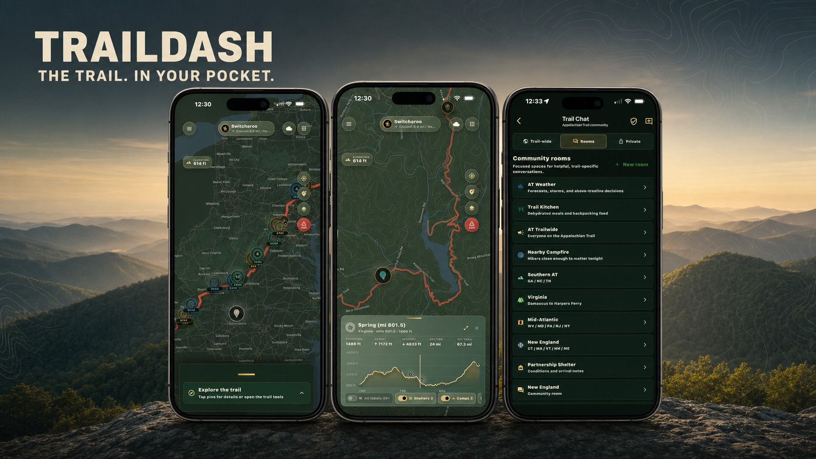
Navigation, connection, and trail life
One app for the hike you planned—and the day you didn’t.
TrailDash carries the Appalachian Trail on your phone: offline topo maps, elevation ahead, shelters, water, services, weather, private location tools, and the conversations that keep a trail community useful.
Straight from the app
This is the real thing.
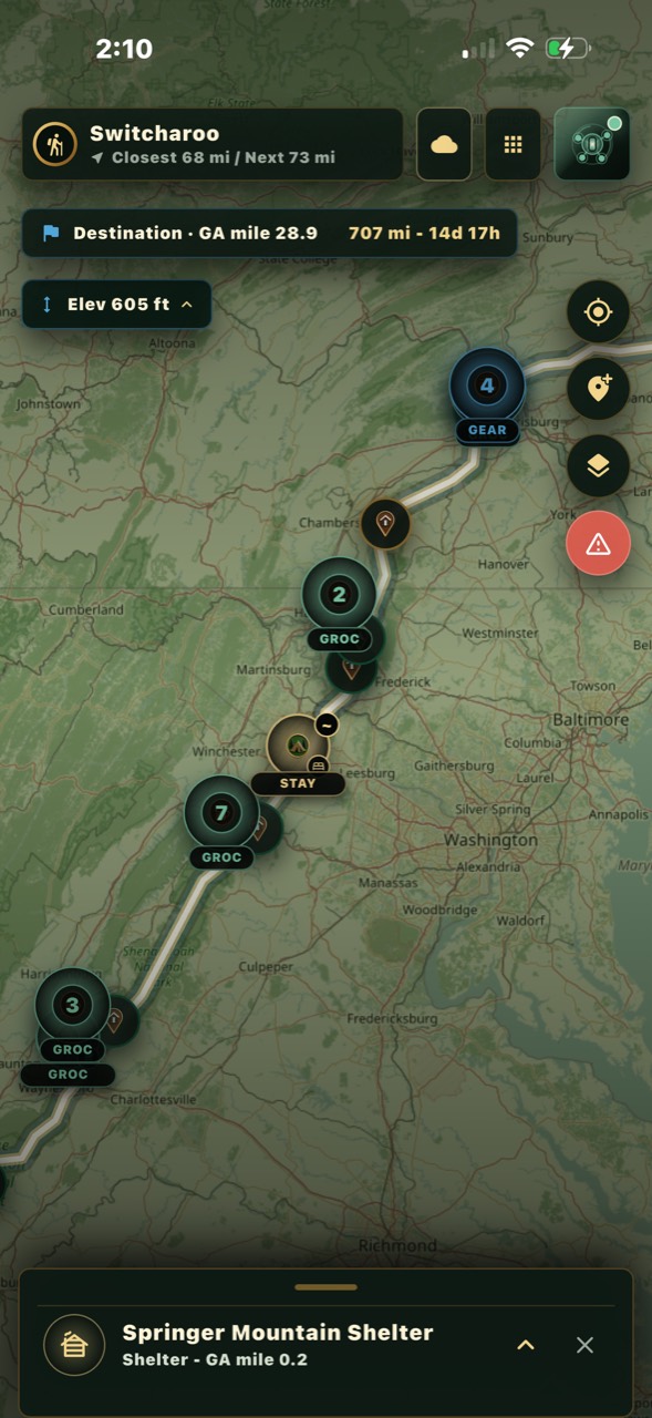
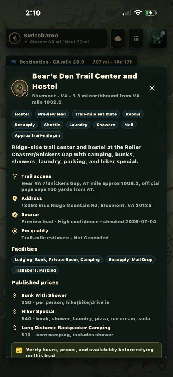
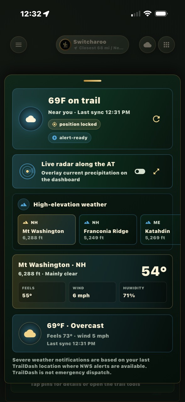
Not a mockup — these are un-retouched screens from the build hikers are carrying right now. Tap through the map, a place, and the elevation ahead.
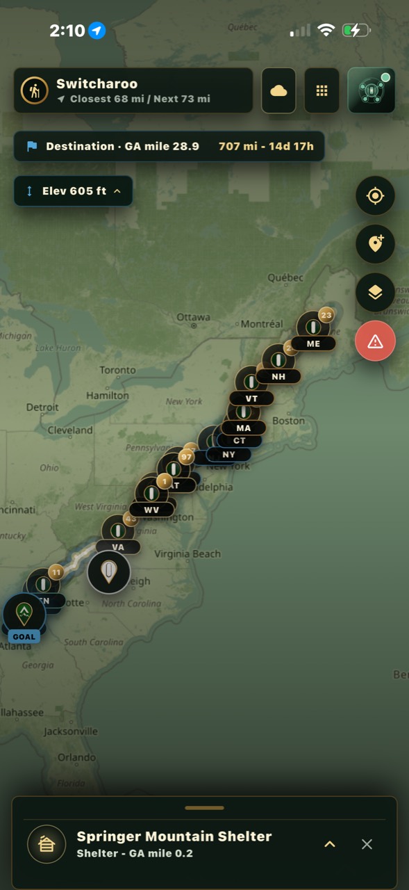
The whole A.T. on offline topo, with shelters, water, and services.
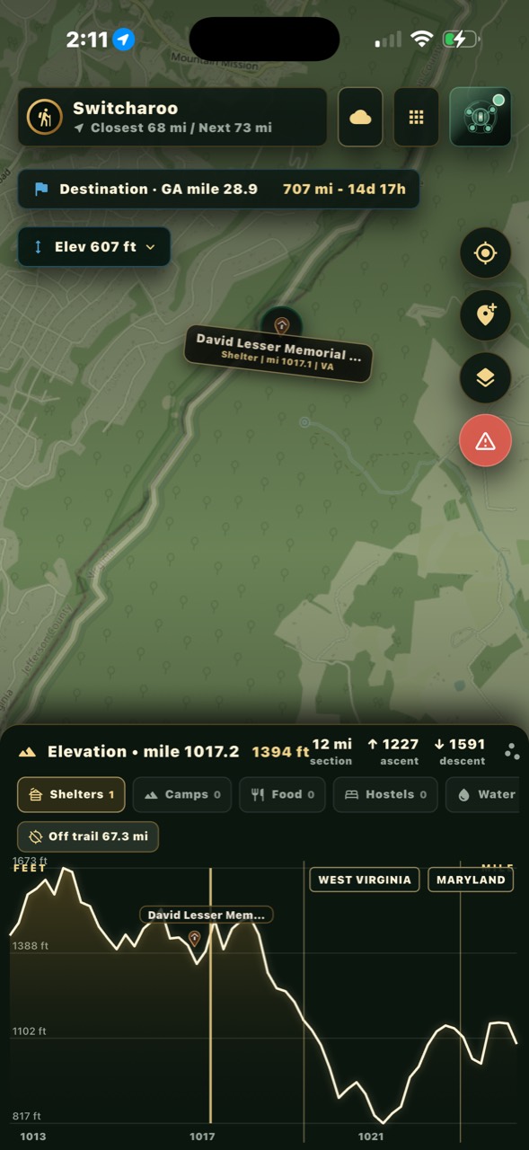
Straight from the current build
Real screens, real trail.
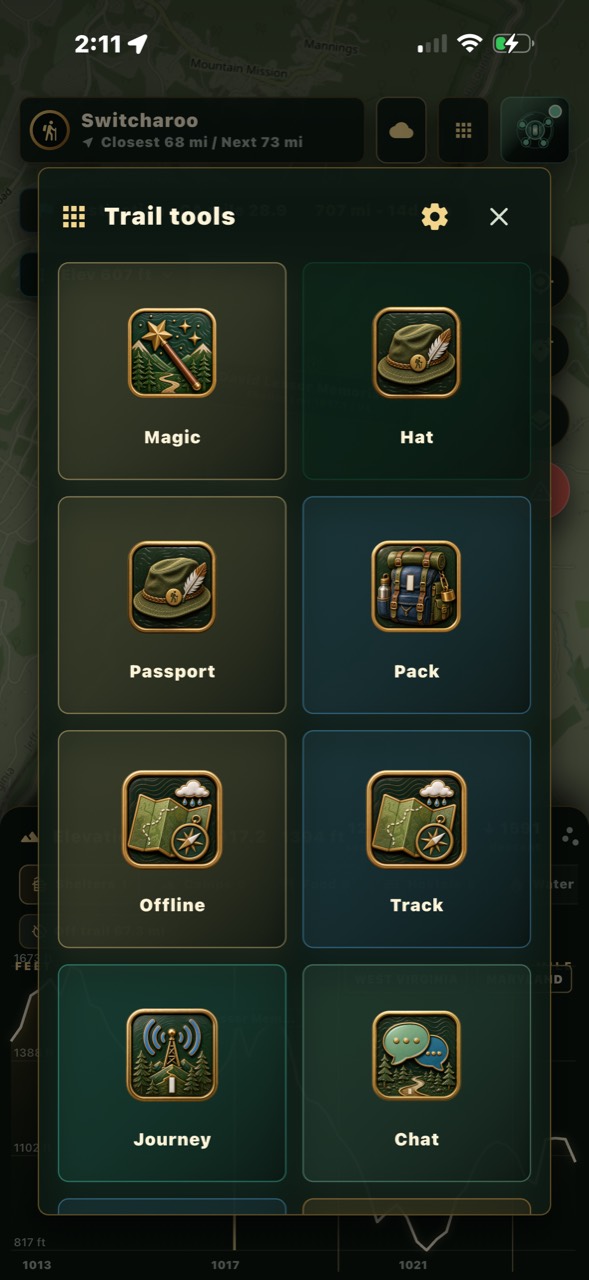
Un-retouched screenshots from the current build hikers are carrying this week.
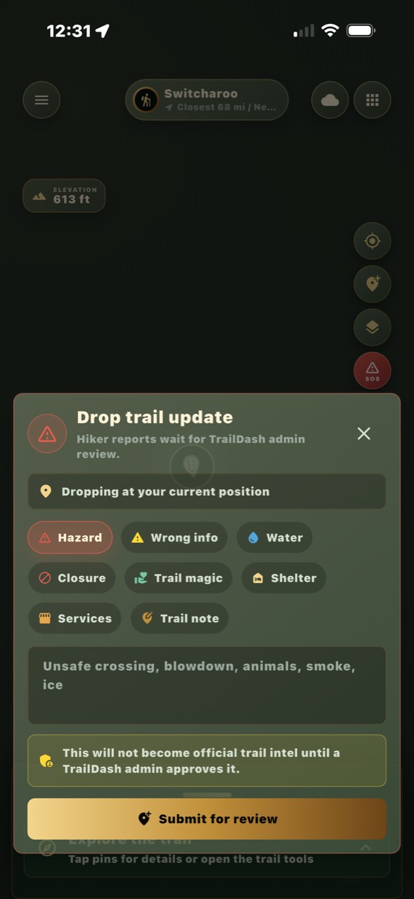
 Offline packs
Route, waypoints, shelter records, service previews, and cached map areas.
 Trail culture
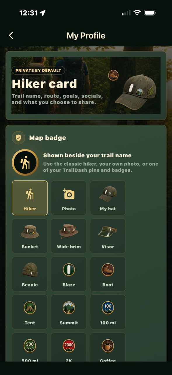
Register notes, trail magic, hiker profiles, badges, and opt-in social context.
 Privacy first
Share location, profile, contacts, journal, and pack details only when you choose.
AT first, not AT only
TrailDash should feel ready for many trails from day one.
Appalachian Trail
Offline map, shelters, water, register, trail magic, social layers, and town context.
Pacific Crest Trail
Long-distance route and resupply model with a lighter, trail-specific field layer.
Continental Divide Trail
Remote navigation, alternates, water context, and offline-first field notes.
Long Trail, Camino, and more
The brand stays wide enough for smaller regional routes and international walking trails.
For the folks who keep hikers fed, clean, and moving
Run a hostel, campground, shuttle, or gear shop near the trail?
TrailDash puts your place on the map hikers actually carry — with the things they decide by: beds left tonight, your prices, what you offer, and a way to reach you before they are standing in your driveway.
“3 bunks left” beats phone tag.
Update beds, campsites, and prices from your phone or a tablet on the desk. One tap. Hikers a day out see it right away.
Requests, not surprises.
Hikers can ask ahead for a bunk, a campsite, or a resupply run. You confirm or decline. Payment stays at your door, the way it always has.
Tell the bubble tonight’s news.
“Live music at 7.” “Kitchen closes early.” One short note reaches hikers within a few miles of you. Two a day, tops — we keep the trail quiet.
Free. Actually free.
No listing fee, no commission, nobody can pay to outrank you. Founding partners keep it that way for good.
Register your place
Takes about five minutes. A real person reviews every claim and gets back to you within a day or two.
What the app holds
Less noise. More useful trail context.
What’s ahead, who sleeps where, water at a glance.
Digital shelter logbooks, tied to real places.
Requests and drops, with trust cues.
Family sees your last shared position on a web page.
One tap prefills every emergency contact — you stay in control.
Trail-wide, weather, recipes, your tramily.
Summit forecasts and live radar over the trail.
GPS-verified stamps, a hat you decorate.
When there is no signal at all
Two hikers, two small radios, no towers.
Cell service on the A.T. is a rumor. TrailDash can also talk over LoRa — long-range radio — so a paired board carries your messages, your SOS, and your position to other TrailDash hikers when there is nothing to connect to. It is optional, and the app works the same without it.
Short for Long Range. Tiny packets, very little power, far past what Bluetooth can reach. No SIM, no plan, no tower — it rides license-free radio spectrum.
Chat messages, an SOS with your coordinates, and your position on the trail map — the same screens you already use, just with no internet behind them.
Every board also relays for the others, so a message can hop hiker to hiker. Terrain decides the rest: open ridgelines carry it a long way, deep gaps and dense cover cut it short.
A Heltec WiFi LoRa 32 V3 board, flashed right here in your browser in about five minutes, then paired to the app over Bluetooth. Charge it with the rest of your gear.
Not a phone line, and not a replacement for a personal locator beacon or satellite messenger. It is short, best-effort text for when nothing else is there.
Straight answers
Questions hikers actually ask.
Does it really work with no service?
Yes. The maps, shelters, water sources, and your own notes are stored on your phone. Messages and updates queue and send when you get signal.
What does TrailDash cost?
TrailDash is $25/year or $5/month so we can keep maps, trail data, hosting, and support current.
iPhone only?
TrailDash is available on iPhone. Android is on the roadmap.
Is my location shared?
Only if you choose. Everything is off by default; you decide what hikers, friends, and family can see, and you can turn it off any time.
Where does the trail data come from?
Public map data and the official centerline, checked against the trail mile by mile — plus corrections from hikers on the trail right now. Every waypoint shows when it was last verified.
I run a business on the trail — what’s the catch?
No catch. Listing, live capacity, reservations, and blasts are free for trail businesses, forever. We make our money from the hiker app, not from you.
See you out there
Come walk with us.
TrailDash is built with the hikers and trail towns of the A.T.